On this page:

Wind turbine visualisations are digital images that illustrate how wind farms might appear to the eye when looking out to sea from certain points on the coastline.
While these images are based on real-life wind turbine designs that have been safely and successfully installed in many parts of the world to generate clean, renewable energy, the images are for illustrative purposes only and do not show an actual offshore wind farm.
Developers awarded a feasibility licence by the Australian Government will need to consult on the location and placement of turbines as part of their management plan and to support assessment under the Environment Protection and Biodiversity Conservation Act 1999.
What might an offshore wind farm look like off the coast of Gippsland?
The Gippsland offshore wind declared area begins at least 10 km from shore, in waters governed by the Australian Government.
To understand what wind turbines off the coast of Gippsland might look like, we have developed a series of interactive images of offshore wind turbines seen from 3 popular locations, Golden Beach, Woodside Beach and Mount Oberon summit (Wilsons Promontory).
For Golden Beach and Woodside Beach, which are close to the Gippsland offshore wind declared area. we have developed renders that illustrate an offshore wind farm at 3 distances from shore – 10 km, 30 km, and 60 km.
For Mt Oberon summit, further in distance from the Gippsland offshore wind declared area but providing the highest vantage point on Wilsons Promontory, we have developed renders that illustrate an offshore wind farm at two distances from the summit – 30km and 60 km.
The distance from Mt Oberon to the declared area, means that 30 kms from shore is the closest that turbines might be, this is unlike Golden Beach and Woodside Beach where the declared area starts at 10 kms from shore.
Understanding these visualisations
The images are for illustrative purposes only and do not show an actual offshore wind farm.
The visibility of offshore wind turbines depends on factors such as distance, time of day, cloud cover, weather conditions including mist or haze, as well as the location, size, orientation and layout of turbines.
Explore the wind turbine visualisations
Discover what an offshore wind farm might look like off the coast of Gippsland by exploring our wind turbine visualisations. These interactive images allow you to move the viewpoint and change the distance setting.
Alternatively, browse through the image gallery.
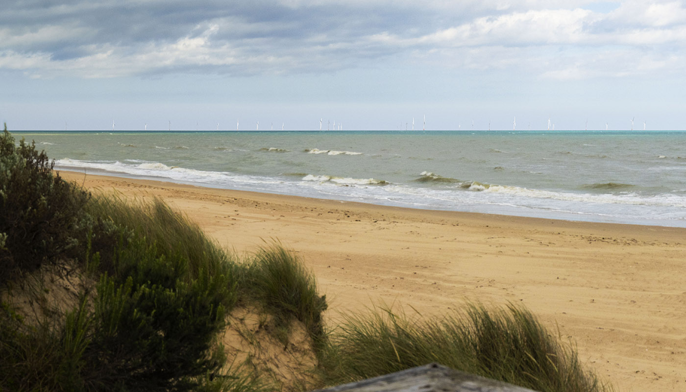
Woodside Beach

-

-

-


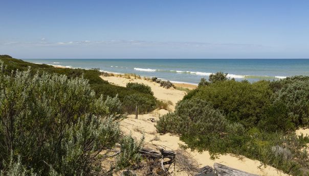
Golden Beach

-

-
-
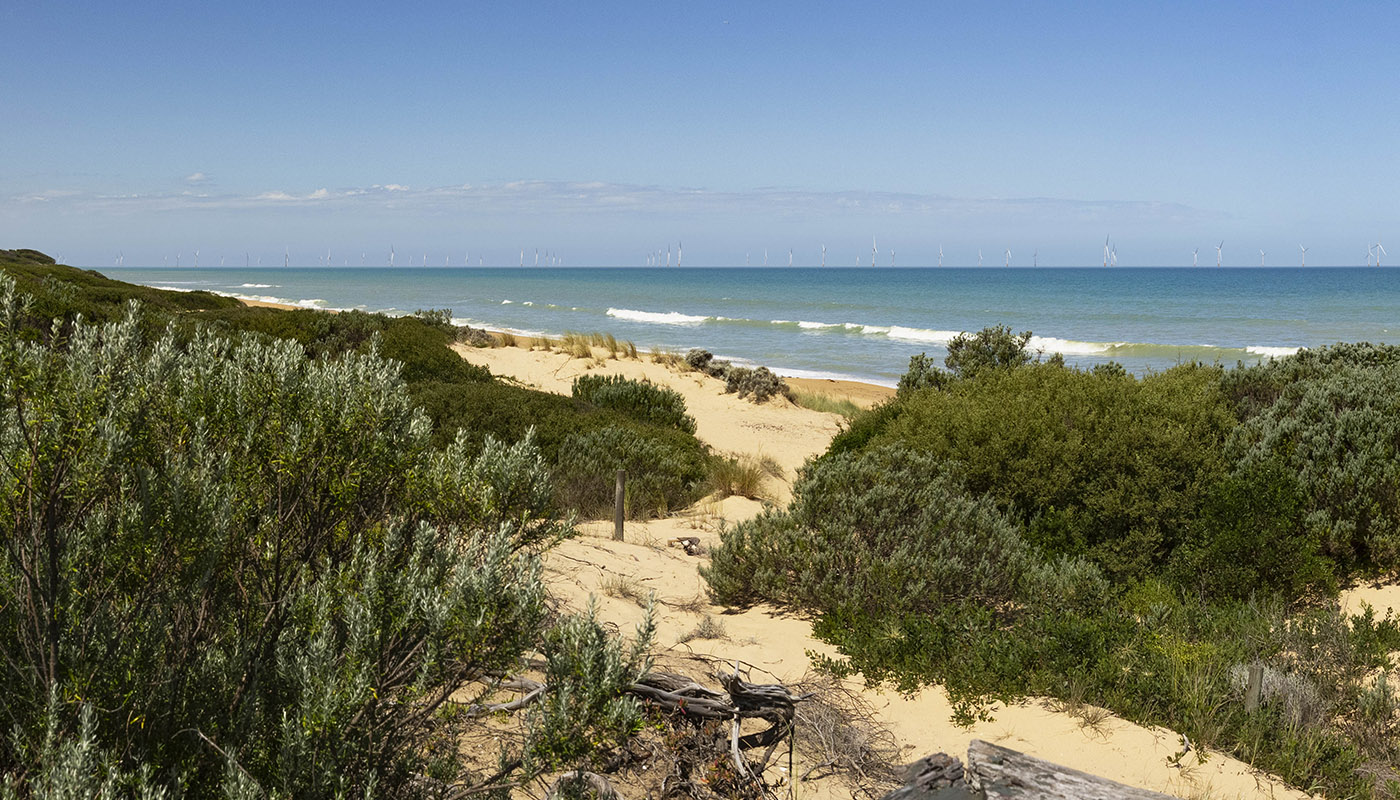
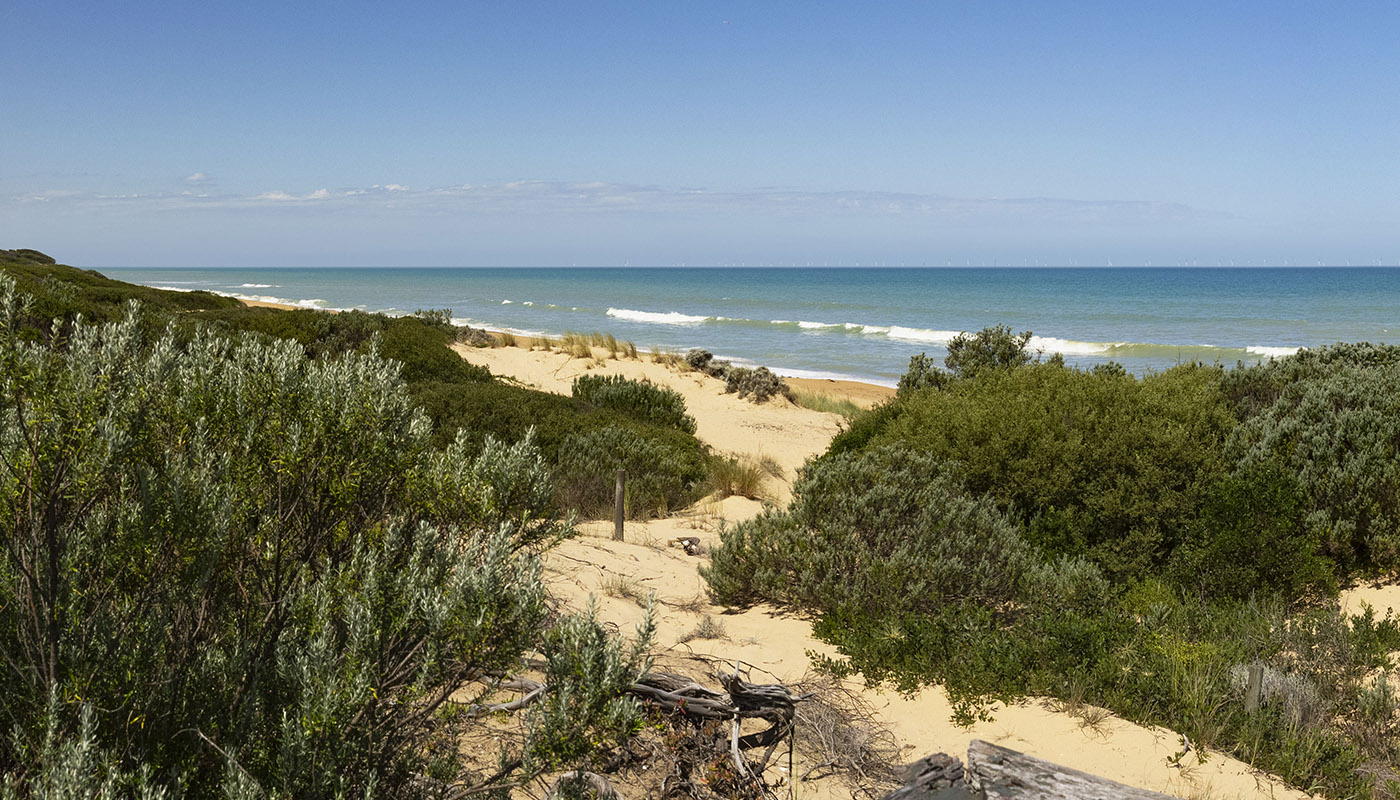

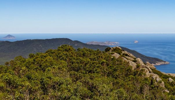
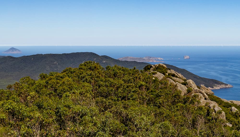
Mt Oberon summit (Wilsons Promontory)
-

-

About the turbine visualisations
Image locations
The locations were chosen because they are popular destinations close to the Gippsland offshore wind declared area.
- Woodside Beach, ramp in front of the surf lifesaving club – GPS coordinates
- Golden Beach, picnic area beach lookout – GPS coordinates
- Mt Oberon summit (Wilsons Promontory) – GPS coordinates
Image specifications
Woodside and Golden beaches
Each image shows a visual representation of a 2 GW offshore wind farm, with 18MW turbines laid out over a rectangular grid at 2 km x 2 km spacing.
The distances of 10 km, 30 km and 60 km offer a broad visual representation of wind turbines in parts 1 and 2 of the Gippsland declared area.
Image technical details
- Date: 15 December 2023
- Time: Golden Beach 14.59; Woodside Beach 16:33
- Elevation (from sea level): Golden Beach 3.6m; Woodside Beach 3m
Mt Oberon summit (Wilsons Promontory)
Each image shows a visual representation of a 2 GW offshore wind farm, with 18 MW turbines laid out over a triangle-shaped grid at 2 km x 2 km spacing.
The distances of 30 km and 60 km offer a broad visual representation of wind turbines positioned in part 3 of the declared area, which starts at a distance from Mt Oberon summit of approximately 30 km.
Image technical details
- Date: 8 March 2024:
- Time: 10:00
- Elevation (from sea level): 560 m
- Visibility factors: Due to white haze on the horizon on the day these images were taken, slight adjustments to the renders have been made to ensure optimal turbine visibility.
How were the images produced?
The images were produced using a digital rendering method that combines photography with information such as GPS coordinates, elevation data, viewing direction, distance calculations to the turbines, and turbine scaling.
The modelled turbines are based on reference wind turbine specifications sourced from the United States National Renewable Energy Laboratory.
The reference wind turbine specifications used in these images are:
- Hub height (height to turbine nacelle): 156m
- Rotor diameter: 263 m
Offshore wind turbine technology is constantly developing; in the future, turbine sizes may be bigger, with a higher generation capacity. This could mean fewer and taller turbines than what is shown in these visual representations. A reference turbine has been used that has general dimensions which may differ from turbines that are currently under design and development.
The images are representative and are not to be used for any other purposes.
Page last updated: 14/10/25